
Week guide · Sikkim
A slow week in Sikkim: Gangtok, North Sikkim and the Kanchenjunga dawns
Seven days in the eastern Himalaya, timed for the few weeks a year when the air is actually clear — plus the permits you cannot get on the day, and the airport that does not work.
- Eastern Himalaya
- Post-monsoon
- 7 days
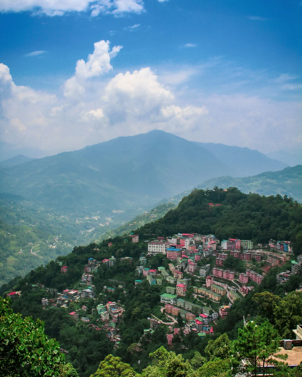
- From Bagdogra125 km4–5 hr to Gangtok
- Clearest viewsOct–NovDawn, not midday
- Time needed7 days5 without North Sikkim
- PermitsRequiredAnd not issued to solos
The short version
Sikkim is the small Himalayan state between Nepal and Bhutan, reached by road from Bagdogra airport near Siliguri — not by flying to Gangtok, whatever the route maps say. October and November are the clear-view weeks, when the monsoon has washed the haze out and Kanchenjunga shows at dawn on most mornings. The catch is paperwork: Tsomgo, Nathula and all of North Sikkim need permits arranged in advance through a registered local operator, and they are not issued to solo travellers. Sort that before you book anything else.
Why Sikkim
Sikkim is small — you could drive its length in a day if the roads let you, which they do not. What it has instead is vertical range: subtropical valleys at 300 m climbing to Kanchenjunga at 8,586 m, the third highest mountain on earth, inside a state you can cross in an afternoon on the map. It became part of India only in 1975, and it still feels distinct: Buddhist monasteries, Nepali and Bhutia and Lepcha communities, and a fully organic farming policy since 2016.
It is also the most administratively complicated state in this series. Much of what people come for sits in restricted border areas, and the permits are not something you can improvise. Plan Sikkim properly or do not plan it at all — the middle path is a week of disappointments at checkposts.
High
Third-highest peak on the skyline
Kanchenjunga is visible from Gangtok, Pelling and half the ridges in between — on the mornings the air is clear.
Restricted
Border country
Nathula sits on the old Silk Road crossing to Tibet. That proximity is why the permits exist.
Green
India’s organic state
Sikkim phased out chemical fertilisers and pesticides entirely. It shows in the food and in the valleys.
When to go
This is the one destination in the series where the timing is genuinely narrow. Mountain views need clear air, and clear air here means the weeks immediately after the monsoon withdraws.
Why now
The monsoon scrubs the haze out. From mid-October, Kanchenjunga shows on the large majority of dawns — the single best odds of the year.
What it costs
Cold at altitude and getting colder. By late December, North Sikkim roads can close on short notice after snow.
Book early
October overlaps Dasain and Durga Puja. Rooms and permits in the popular weeks go well before you think they will.
Why then
Rhododendrons through the middle hills, warmer days, and the high valleys opening up again after winter.
What it costs
Haze. The air thickens as spring goes on and the big peaks spend more mornings hidden.
Avoid
June to September. The monsoon is heavy here and landslides close the North Sikkim road regularly.
Set an alarm
Whichever month you pick, the mountain is a dawn event. Kanchenjunga is usually clear at first light and gone behind cloud by mid-morning. If you are not up before sunrise you will not see it, and no amount of good weather changes that.
Permits: sort this before anything else
Most of Sikkim is open, but almost everything on a first-timer’s list is not. Tsomgo Lake, Baba Mandir, Nathula, Zuluk and all of North Sikkim beyond Chungthang — Lachen, Lachung, Yumthang, Zero Point and Gurudongmar — sit inside protected areas and need a permit.
The part people get wrong
Permits are not issued to individuals directly. You apply through a registered Sikkim travel operator, with a passport photo and ID, and it takes about a day to process. That means solo travellers cannot get these permits alone — you join a group or hire a vehicle through an agency. Budget roughly ₹400–500 per person per permit, and confirm current rules with your operator, because they change with weather and security instructions.
- Indian citizens need a Protected Area Permit for the areas above. No Inner Line Permit is needed to enter Sikkim itself.
- Foreign nationals need a Restricted Area Permit to enter Sikkim, and are barred outright from Nathula, Gurudongmar and Zuluk. Lachung and Yumthang are generally allowed with the right permit; check before booking.
- Nathula runs on limited days and is subject to Army clearance. It closes at no notice for weather or operational reasons, and there is no refund for the view you did not get.
- North Sikkim permits come with a minimum itinerary — typically a set number of nights in Lachen and Lachung rather than a day trip. Your operator will structure it.
Getting there
Everyone arrives through Siliguri, in the plains of West Bengal, and drives up.
- FlyBagdogra (IXB), then roadThe real gateway. About 125 km to Gangtok, 4–5 hr on hill roads.
- Don’tPakyong (PYG), near GangtokSikkim’s own airport currently has no scheduled commercial flights. Do not plan around it.
- RailNew Jalpaiguri (NJP)Siliguri’s railhead, well connected from Kolkata and Delhi. Then the same drive.
- RoadNH-10 along the TeestaBeautiful and landslide-prone. Allow buffer, especially late in the monsoon.
- LocalShared jeeps and hired vehiclesShared sumos link the towns cheaply. Restricted areas need an agency vehicle anyway.
On Pakyong
Pakyong airport exists, is genuinely spectacular, and appears on plenty of booking sites and older guides — but civil aviation traffic figures for the last full year show no scheduled passenger movements at all. If a plan depends on flying into Sikkim, check live schedules before you commit, and assume Bagdogra otherwise.
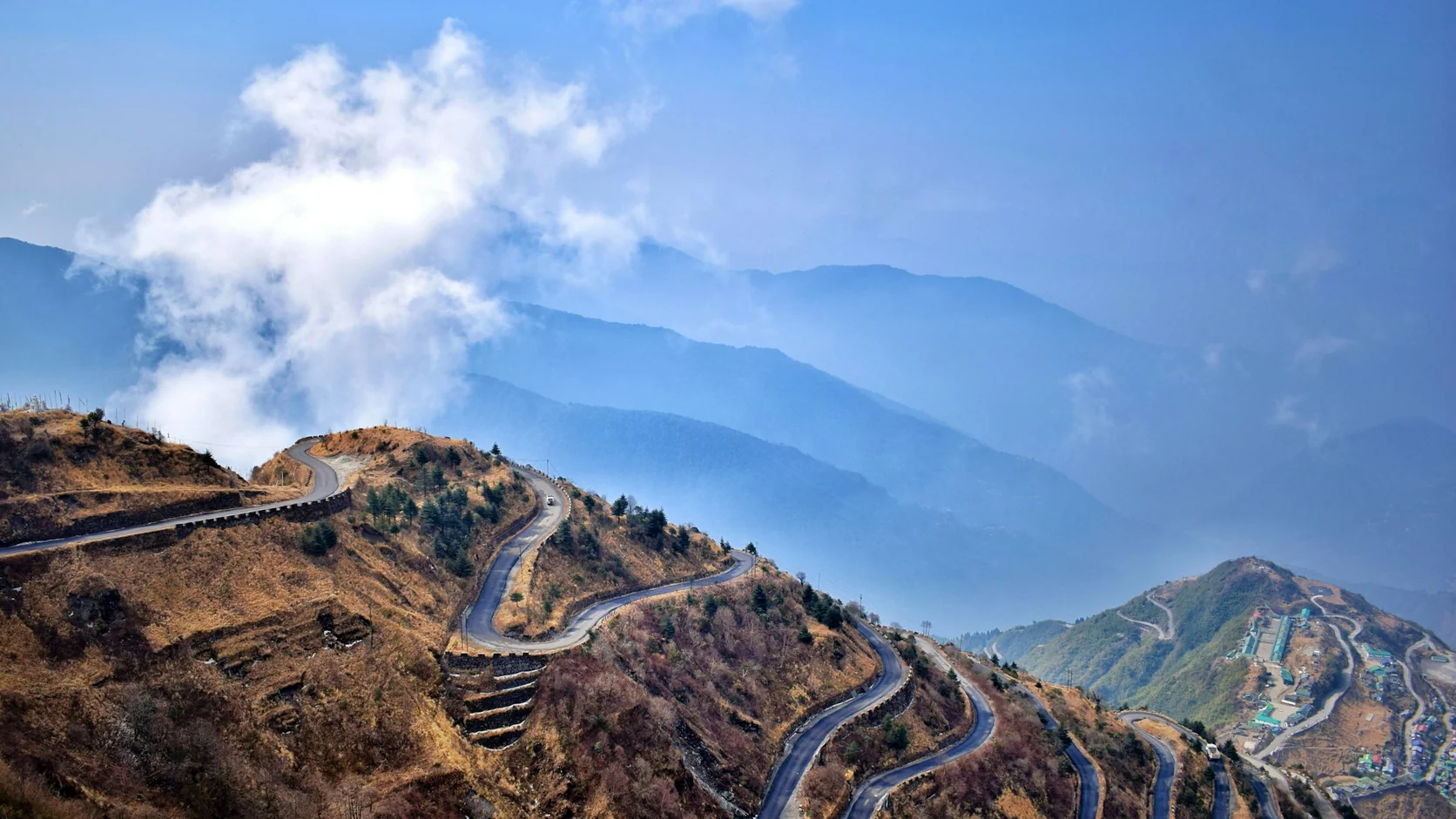
Gangtok
The capital sits on a ridge at about 1,650 m and is the base for everything. It is more built-up than people expect — a working hill city rather than a village — and it is where your permits get processed, so you will spend a night here regardless.
- 01
Tashi Viewpoint at dawn
About 8 km north of town, and the standard sunrise spot for Kanchenjunga. Go before first light. From mid-October the odds of a clear dawn here are genuinely good; in spring they are not.
- ~8 km north
- Pre-dawn
- Best Oct–Dec
- 02
Rumtek Monastery
The largest monastery in Sikkim, about 24 km out, and the seat of the Karma Kagyu lineage. Working monastery, not a museum — go in the morning, keep quiet, and carry ID as there is a security check.
- ~24 km
- Half day
- Carry ID
- 03
MG Marg
The pedestrianised main street: no vehicles, no litter, no spitting, and benches down the middle. It is where the town walks in the evening, and the most pleasant hour you will spend in the city.
- Central
- Evening
- Vehicle-free
Tsomgo, Baba Mandir and Nathula
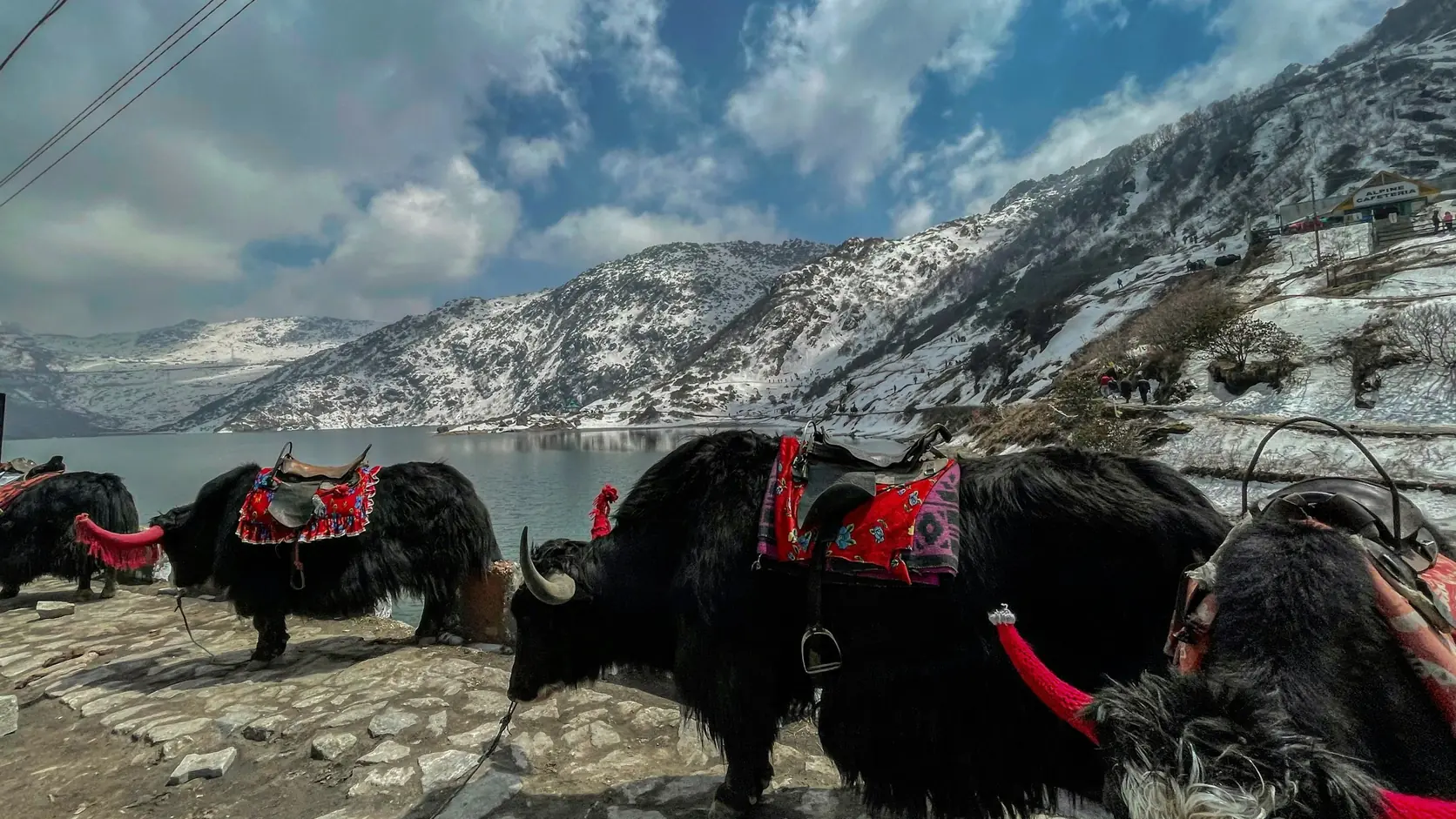
The classic day trip east of Gangtok, done as a single permitted circuit. Tsomgo Lake sits at about 3,750 m, roughly two hours up from the city, and freezes over in deep winter. Baba Mandir and the Nathula pass on the Tibet border are further along the same road.
Two things to accept before you book it. First, the altitude gain is abrupt — you go from 1,650 m to nearly 4,300 m at Nathula and back in a day, which a fair number of people feel. Second, Nathula is a border post on an active frontier: it opens on limited days, it closes for weather or operations without warning, and foreign nationals cannot go at all.
- Do it early in the trip only if you are acclimatising deliberately — otherwise it is a hard first full day.
- Hire the boots and coat at the lake. Stalls at Tsomgo rent gumboots and heavy jackets; it is colder up there than Gangtok suggests.
- Treat Nathula as a bonus, not the plan. Plenty of trips get the lake and the temple and no pass.
The rule
The mountain is a dawn event. Everything else on the itinerary can move; sunrise cannot.
— Travel India
North Sikkim: Lachen, Lachung and Gurudongmar
This is the part of the state people remember, and the part that needs the most care. The road runs north up the Teesta to Chungthang, where it splits — Lachen one way, Lachung the other. Both are small high villages used as staging posts for dawn runs further up.
- 04
Gurudongmar Lake
At about 5,430 m, one of the highest lakes in the world. Vehicles leave Lachen around 4 or 5am to be there for sunrise and back down by midday, because nobody should linger at that altitude. Indian citizens only.
- 5,430 m
- Pre-dawn start
- Permit required
- 05
Yumthang Valley
The “valley of flowers” above Lachung, at around 3,600 m. Rhododendrons in spring, bare and beautiful in autumn, with hot springs nearby. Far gentler than Gurudongmar and worth a slow morning.
- ~3,600 m
- Half day
- Best Apr–May
- 06
Zero Point
Where the metalled road simply ends, above Yumthang at roughly 4,600 m. Snow most of the year and a popular add-on — but it is another significant altitude gain on top of an already high day.
- ~4,600 m
- Optional
- Extra permit
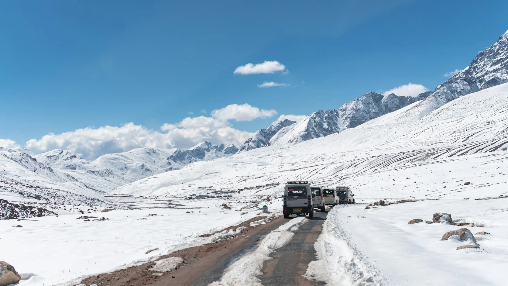
West Sikkim and Pelling
If North Sikkim is the ordeal, west Sikkim is the reward — lower, greener, far less regulated, and with arguably the better mountain view. Pelling sits at about 2,150 m looking straight at the Kanchenjunga massif, and needs no special permit at all.
- Pelling at dawn. The view from the town itself is the draw; you do not need to go anywhere. Rooms advertised as mountain-facing are worth the premium here.
- Pemayangtse and Rabdentse. One of Sikkim’s oldest monasteries, and the ruins of the old capital on a ridge a short walk away. Go together, in a morning.
- Khecheopalri Lake. A sacred lake in forest, held to have no leaves on its surface. Quiet, and a useful counterweight to the high-altitude days.
- It is a long transfer. Gangtok to Pelling is only about 110 km but takes five hours or more. Build it in as a travel day, not an afternoon.
A seven-day plan
Ordered so the altitude builds instead of spiking, with permits arranged before you leave home.
- Day 1Bagdogra → GangtokLand, drive up the Teesta, sleep at 1,650 m. Operator collects IDs for permits.
- Day 2Tashi dawn, Rumtek, MG MargA gentle acclimatising day at Gangtok height.
- Day 3Tsomgo, Baba Mandir, NathulaThe permitted circuit. Back down to sleep in Gangtok.
- Day 4Gangtok → LachenLong drive north. Early night; the morning start is brutal.
- Day 5Gurudongmar, then LachungLeave at 4am, lake at sunrise, down and across by evening.
- Day 6Yumthang → GangtokValley in the morning, then the long road back south.
- Day 7Gangtok → BagdograAllow the whole day. Landslide delays are normal, not exceptional.
If you have nine days
Add Pelling after North Sikkim rather than cutting anything. It is the best mountain view in the state and the only part of this itinerary that does not involve a checkpost.
Altitude, and other things that actually help
Take the altitude seriously
Gurudongmar is at 5,430 m and most itineraries get you there within three or four days of leaving the plains. That is fast. Headache, nausea and breathlessness are common; if symptoms are more than mild the only reliable treatment is to go down, and your driver will know that better than you do. Anyone with heart or respiratory conditions, and anyone pregnant, should take medical advice before booking this leg at all.
- Carry originals, not photocopies. Permits are checked against photo ID at multiple posts. Keep a couple of spare passport photos too.
- Cash matters. ATMs exist in Gangtok and thin out fast heading north. Card acceptance in Lachen and Lachung is unreliable.
- Layers, and a windproof outer. A Gurudongmar morning can be well below freezing with wind, even when Gangtok is mild.
- Signal is patchy and often absent. Download offline maps. In much of North Sikkim only some networks work at all.
- Build buffer at the end. NH-10 closes for landslides with some regularity. Do not book a same-day connecting flight out of Bagdogra.
- Drink more water than feels necessary and go easy on alcohol at altitude. Both help more than any supplement.
FAQs about Sikkim
Do I need a permit to visit Sikkim?
Indian citizens do not need a permit to enter Sikkim, but do need a Protected Area Permit for Tsomgo, Baba Mandir, Nathula, Zuluk and all of North Sikkim beyond Chungthang. Foreign nationals need a Restricted Area Permit to enter the state and are not permitted at Nathula, Gurudongmar or Zuluk at all.
Can I travel Sikkim solo?
You can travel the unrestricted parts — Gangtok, Pelling, most of west and south Sikkim — entirely independently. But protected-area permits are not issued to individuals directly; they go through a registered operator, so for Tsomgo, Nathula and North Sikkim you will need to join a group or book a vehicle through an agency.
When is Kanchenjunga actually visible?
Most reliably from mid-October through December, at dawn. After the monsoon clears the haze, the odds of a clear first light run high through October and November. The mountain typically clouds over by mid-morning in any season, so sunrise is the window regardless of month.
Is there an airport in Gangtok?
Pakyong airport is about 30 km from Gangtok, but it currently has no scheduled commercial flights — the last full year of civil aviation figures shows no passenger movements. Fly to Bagdogra near Siliguri and drive the remaining 125 km, which takes four to five hours.
How serious is the altitude at Gurudongmar?
Serious enough to plan around. The lake is at roughly 5,430 m and most trips reach it within a few days of arriving from sea level. Trips leave Lachen before dawn and return by midday specifically to limit time up there. Treat any symptom beyond a mild headache as a reason to descend.
How many days do I need?
Seven is the working minimum for Gangtok, the Tsomgo circuit and North Sikkim without rushing the altitude. Five covers Gangtok and Pelling comfortably if you skip the north. Nine lets you do all of it and still have a buffer day for the road.
Plan with us
Planning a Sikkim trip?
I help travellers plan slow, well-paced India trips that get the seasons, permits and altitude right — including Sikkim, Darjeeling and the wider eastern Himalaya. Free 48-hour reply.
Plan my India trip →
Written by Ashvinee Nagle
I travel India slowly and write it down honestly - practical guides and real itineraries from someone who lives here.
About Ashvinee →Plan your India trip with us
Get one short, honest India travel guide a week — plus a free 7-day Rajasthan itinerary to start.
Free. Unsubscribe any time.